Hoo St Werburgh and Chattenden Neighbourhood Plan - Regulation 16
8. Travel Infrastructure
Purpose
To promote balanced and sustainable transport infrastructure.
Evidence and Planning Rationale
National Policy
Chapter 9 of the NPPF deals with Promoting sustainable transport. This includes consideration of impacts of development, existing and proposed infrastructure, promotion of walking, cycling, and public transport, environmental impacts, and movement, streets, and parking in the design of schemes.
Local Policy
The Medway Local Plan 2003 contains policies relating to transport. These are now somewhat out-of-date due to the age of the plan, changes to national policy and guidance, technological change, the impact of COVID and the increasing priority given to climate change. However, many policies are still consistent with the NPPF and have been recognised as such by a number of planning inspectors in appeal cases.
Chapter 8 deals with Transport and includes:
- L10: Public Rights of Way
- T1: Impact of Development
- T3: Provision for Pedestrians
- T4: Cycle Facilities
The Neighbourhood Plan provides more up-to-date policies, with an emphasis on active travel.
Other Documents
Medway Council's The Infrastructure Position Statement' 2017 is a high-level commitment to ensuring that infrastructure is in place as development happens and that all needs are catered for. This will be developed into a full Infrastructure plan so that the policies at neighbourhood level here are proposed to ensure that developers are clear about the need to consider the impact of their proposals on current infrastructure provision and to ensure that the provision of new infrastructure is provided for as part of their developments where required.
The Medway Rights of Way Improvement Plan 2020 to 2030 sets out proposals for enhancement.
The Hoo St Werburgh Design Codes document prepared by AECOM (November 2021) has informed this and other policies.
Planning Background
Engagement and evidence suggests that transport infrastructure in the Neighbourhood Area is deficient in certain respects:
- pedestrian connectivity is poor, including poor links between new housing development and the existing footpath network;
- roads are unsafe for pedestrians and cyclists due to traffic speeds, lack of pavements and pollution.
- roads are also unsuitable for their current traffic volumes and vehicle types due to their rural character and on-street parking.
Size of car parking spaces and garages provided in relation to modern car sizes. This has been recognised by both the Automobile Association and National Car Parks, with damage to cars, problems turning and garages being too small to accommodate modern cars being recognised problems due to an increase in car sizes since the common standard of 2.4 x 4.8m was adopted. The policy interpretation suggests a more suitable standard for modern vehicles.
Public transport provision is currently a serious impediment to the sustainability of the villages of the Neighbourhood Area. The nearest train stations are at Strood and Rochester for connections to the Medway towns and London where most people locally need to travel for work and leisure. Hoo and Chattenden have a regular bus service from the village centre and Hoo Marina to the Medway Towns, although new developments on the outskirts of the parish are disadvantaged due to the distance to bus stops.
The Peninsula Way (A228) is the only access road through the Parish and serves the whole Parish, the industrial areas to the east and the rest of the peninsula and the villages beyond. It is also the only real access available to connect with the Medway towns and accessing routes to the rest of Kent and London. Medway Council advises that the Peninsula Way, which is the main artery route to, from and through the Parish to the wider Peninsula is already at capacity, which has been a consideration in recent planning appeals.
There is provision for walking and cycling throughout the Parish, but a severe lack of route connectivity. Over 50% of local residents travel to work by car and increased car ownership since 2011 means that existing road infrastructure is under pressure in terms of parking, overall volumes and types of vehicles
There should be improved connections to footpaths and open spaces, improved public transport, provision of cycleways and improved safety and condition of all roads in the Parish. This is necessary to provide a balanced range of transport choices and more sustainable live-work patterns.
They also provide opportunities for outdoor pursuits walking along public Rights of Way, sharing, and enjoying the local environment, ecology, landscape, and social history. Other activities include walking parts of the WWII stop line, the England Coastal Path by Natural England, Saxon Shore Way (part of the England Coast path), cycling, running, and sailing. There is a need for access to as many of these activities as possible for the less abled members who live, work, or visit within our community.
HOO11: Sustainable Transport and Active Travel
- Development that is likely to generate journeys must support a balanced range of transport options, including active travel and sustainable forms of transport, meeting the requirements of this policy proportionate to the scale and nature of the scheme.
- Parking provision for development should include:
- Covered and secure storage for cycles, with electric charging points;
- Electric charging points for motor vehicles.
- Development must be supported by adequate road infrastructure to safely support additional traffic movements, with additional pedestrian crossings where necessary.
- Development layouts must create a convenient, safe and attractive environment for pedestrians with differing levels of mobility, linking to surrounding paths, community facilities and public transport, and creating good linkages within the site, also meeting the requirements of Policy HOO6.
- Each new home should include adequate parking provision for the size of property and garages and parking spaces should be adequate to accommodate modern vehicles.
- New roads should be of sufficient width to allow for easy passage of service vehicles and emergency vehicles and, where appropriate, public transport.
Interpretation
For new housing, employment or other development, the policy ensures that sustainable modes of transport are provided, in addition to meeting parking and other requirements set out in the Local Plan.
Active travel includes cycling and walking.
The policy requires cycle storage and electrical charging points. For housing, this is also covered by Policy Hoo5.
In providing adequate parking, mixed provision could include garage spaces, carports, and curtilage spaces. The aim should be to ensure that streets, spaces and the public realm are not dominated by parking. Planting can be an effective way of reducing the visual impact of parking. Use of trees, hedges and verges can help to create a greener environment in new housing.
To meet the requirements of this policy and the design policy, new development should create permeable, safe and attractive walking routes and networks for pedestrians and cycles within sites, as well as connecting to the wider locality and to public footpath networks in the countryside beyond. A permeable street network at all levels provides people with a choice of different routes and allows traffic to be distributed more evenly across the network rather than concentrated on to heavily trafficked roads. The needs of all users of any development should be taken into account in the design process. This includes children and their carers, elderly people and people with disabilities. Designs should encourage social interaction while facilitating movement.
In designing parking in housing developments, the preference of the neighbourhood plan is for garage and parking spaces to be provided within the curtilage of each property, rather than shared facilities. Where shared parking is provided, it should be visible from the properties it serves. Planting can be used to soften the impact of parking.
The Hoo St Werburgh Design Codes document prepared by AECOM (November 2021) and the National Model Design Code may be useful in securing compliance with the policy.
The dimensions of garages and parking spaces must be adequate to accommodate larger modern vehicles, including space for door opening.
HOO12: Paths
- Development must not encroach or have any adverse impact on the safety, amenity or accessibility of public rights of way, the national cycle route, or bridleways, including the Saxon Shore Way.
- Development adjacent to public rights of way, the national cycle route, or bridleways, including the Saxon Shore Way, should take any opportunities to enhance the safety, amenity or accessibility of the route.
- Development of the sea wall will be supported from Kingsnorth to Chattenden to encompass Cockham Fort and any future parkland, to join up with the National Coastal Footpath.
Interpretation
The policy recognises the importance of paths, both for getting around, and in supporting recreation and healthy lifestyles.
Examples of adverse impacts could include where development presents black elevations or high fences flanking a path, so as to create an unsafe and visually unappealing environment.
Examples of enhancements could be where development flanked a path with high quality landscaping or provided active frontages overlooking a path, providing natural surveillance. Care is required in creating new access to paths, recognising the potential for bird disturbance, for example from dogs off leads.
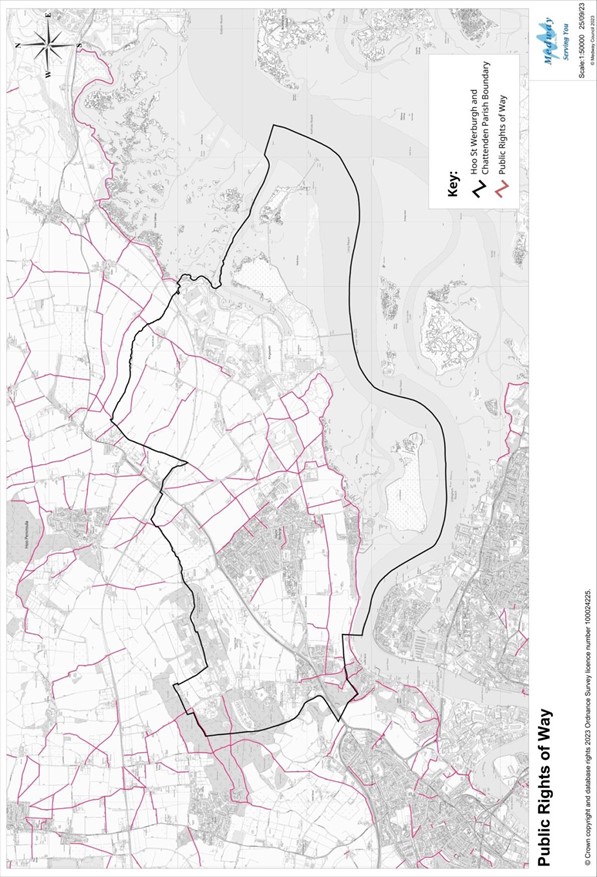
List of Footpaths
|
Path No. |
Locality |
Description |
Unique Street Reference No. |
|
RS338 |
Hoo St Werburgh |
From near the Power Station to RS92 |
32105273 |
|
RS351 |
Hoo St Werburgh |
From Vicarage Lane to Abbots Court Road |
32105279 |
|
RS351A |
Hoo St Werburgh |
From Abbots Court Road (adjacent Willow Cott) to RS351B |
32105292 |
|
RS351B |
Hoo St Werburgh |
From Abbots Court Road (at start of RS351A) to RS111 |
32105293 |
|
RS352 |
Hoo St Werburgh |
From RS90 (360m south of end point) to RS95 (100m to rear of Eshcol Farm Cottages Cottages) |
32105280 |
|
RS49 |
Hoo St Werburgh |
From Vicarage Lane to RS93 |
32105155 |
|
RS88 |
Hoo St Werburgh |
From Sharnal Street to Stoke Road (By Beluncle Halt) |
32105192 |
|
RS89 |
Hoo St Werburgh |
From White Hall Farm (rear of G2) to RS108 |
32105193 |
|
RS90 |
Hoo St Werburgh |
From RS111 to Jacobs Lane |
32105194 |
|
RS91 |
Hoo St Werburgh |
From Stoke Road to Jacobs Lane |
32105195 |
|
RS92 |
Hoo St Werburgh |
From Jacobs Lane to RS90 |
32105196 |
|
RS93 |
Hoo St Werburgh |
From Upnor Road (Jetty) to RS338 |
32105197 |
|
RS94 |
Hoo St Werburgh |
From Stoke Road to Ropers Lane a from Stoke Road (adjacent to Abbots Court Lodge) to RS95 |
32105198 |
|
RS95 |
Hoo St Werburgh |
From Abbots Court Road to Jacobs Lane |
32105199 |
|
RS96 |
Hoo St Werburgh |
From Stoke Road to RS351A |
32105200 |
|
RS97 |
Hoo St Werburgh |
From Abbots Court Road to Saxon Shore Way |
32105201 |
|
RS98 |
Hoo St Werburgh |
From Kingsnorth Close (opposite No. 88 Bells Lane) to RS112 (195m to rear of St Werburgh Medical Centre) and from Ropers Lane (at junction with Ropers Green Lane) to Grandsire Gardens (180m to rear of No. 34) |
32105202 |
|
RS99 |
Hoo St Werburgh |
From RS112 to Bells Lane |
32105203 |
|
RS100 |
Hoo St Werburgh |
From Abbots Court Road to Vicarage Lane |
32105204 |
|
RS101 |
Hoo St Werburgh |
From Bells Lane to Trubridge Road |
32105205 |
|
RS102 |
Hoo St Werburgh |
From The Windmill PH to Pankhurst Road |
32105206 |
|
RS103 |
Hoo St Werburgh |
From Vicarage Lane (side of 1 Withecombe Cottages) to Vicarage Lane |
32105207 |
|
RS104 |
Chattenden |
From Main Road (opposite No. 250) to Main Road (300m south of No. 250) |
32105208 |
|
RS105 |
Chattenden |
From Broadwood Road (rear of No. 18) to Cockham Cottages |
32105209 |
|
RS105A |
Hoo St Werburgh |
From Cockham Cottages to Vicarage Lane |
32105287 |
|
RS106 |
Chattenden |
From Chattenden Lane (opposite Tudor Lodge) to Margetts Place |
32105210 |
|
RS108 |
Hoo St Werburgh |
From Eschol Road (adjacent Electricity Sub Station) to Stoke Road (opposite North Street Farm) |
32105212 |
|
RS110 |
Hoo St Werburgh |
From Stoke Road to Peninsula Way |
32105214 |
|
RS111 |
Hoo St Werburgh |
From Stoke Road to Abbots Court Wharf |
32105215 |
|
RS112 |
Hoo St Werburgh |
From Abbots Court Road (adjacent Willow Cott) to RS351B |
32105292 |
|
RS116 |
Chattenden |
From Beacons Cottage to RS106 |
32105217 |
|
RS119 |
Chattenden |
From Granary Cottage (near) to Hoo Road |
32105219 |
Source: Medway Public Rights of Way Improvement Plan 2020-2030
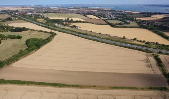
Aerial view of agricultural landscape.