High Halstow Neighbourhood Plan - Regulation 16
Ended on the 30 April 2023
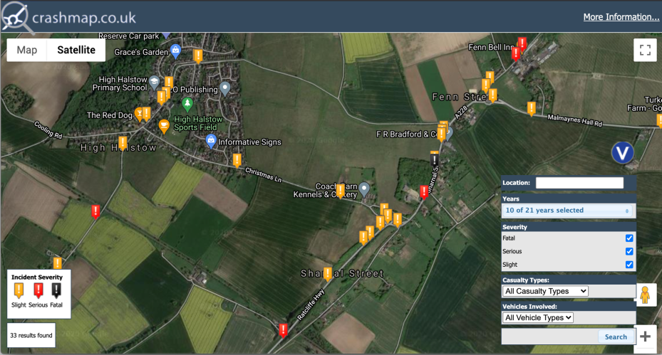
Appendix 3: Traffic Accident Mapping
This section includes maps extracted from Crashmap.co.uk plotting the location and severity of all reported traffic accidents over the ten year period 2010-2019 inclusive, with a particular focus on the stretch of the A228 Ratcliffe Highway north from the location of the proposed new railway station in the Medway Hoo Peninsula Planning Framework.
Please read the help guide if you are using this consultation platform for the first time.
